

Making field data accessible + actionable


Agerpoint Capture is currently supported on:
iPhone 15 Pro & Pro Max | iPhone 14, Plus, Pro & Pro Max | iPhone 13, Mini, Pro & Pro Max | iPhone 12, Mini, Pro & Pro Max, iPhone XS, Max | iPhone XR | iPhone X | iPhone 8, Plus | iPhone SE (2nd & 3rd Generation)
12.9-inch iPad Pro (1st - 6th Generation) | 11-inch iPad Pro (1st - 4th Generation) | 10.5-inch iPad Pro | 9.7-inch iPad Pro | iPad (5th - 10th Generation) | iPad Mini (5th & 6th Generation) | iPad Air (3rd - 5th Generation)
Android devices running version 7.0 or higher
+ More Devices Coming Soon!
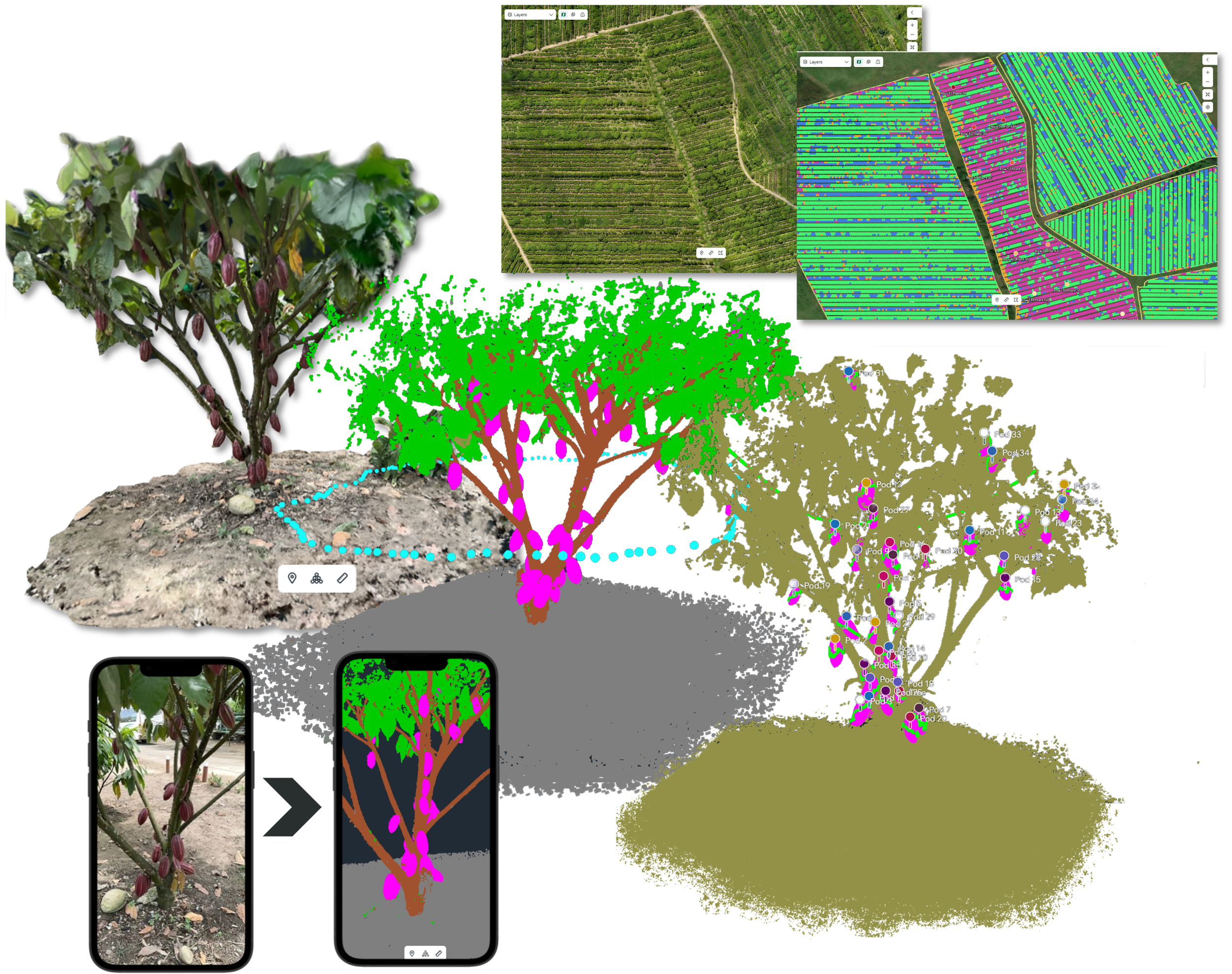
3D Model from Smartphone | Tree Inventory and Biomass
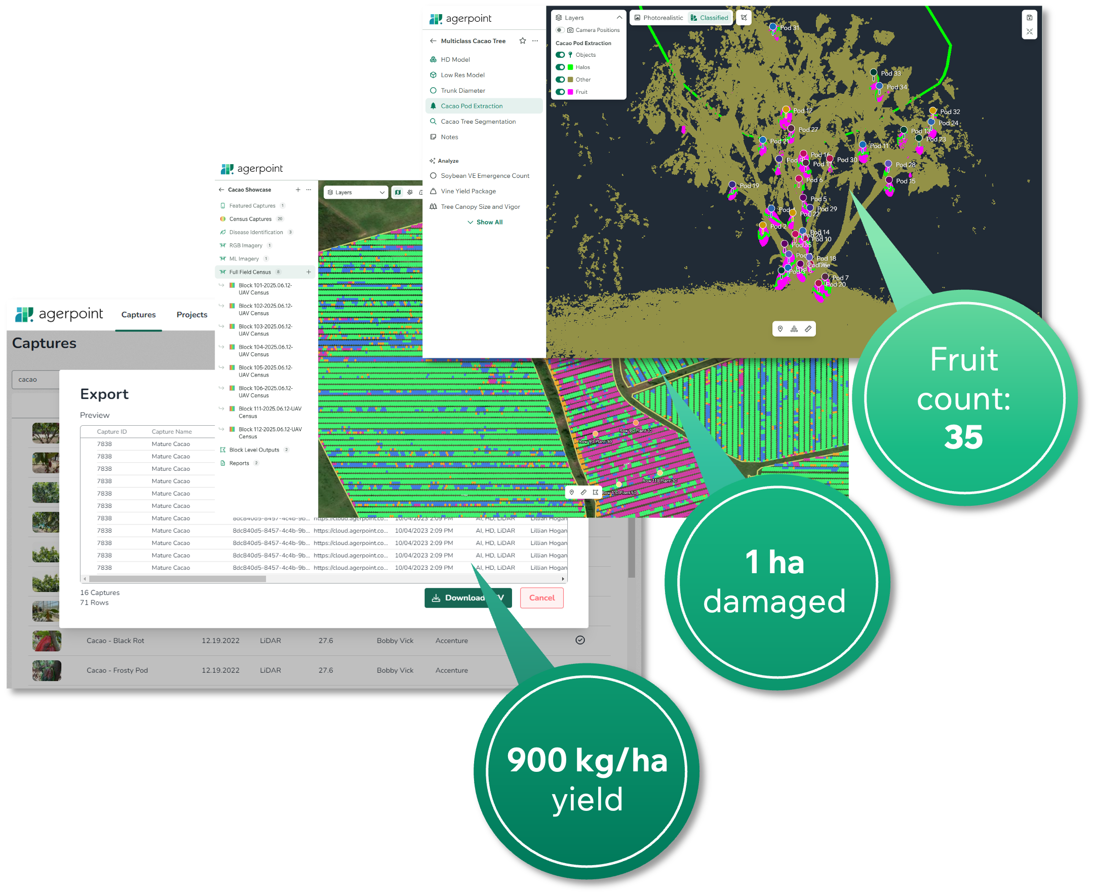
Intuitively organize, manage and interact with 2D and 3D datasets.
Generate crop, plant and/or use case-specific metrics, correlations and insights.


Upload models from the Agerpoint Capture app for detailed measurements including canopy size, trunk diameter, fruit count, disease presence, species identification, and more.
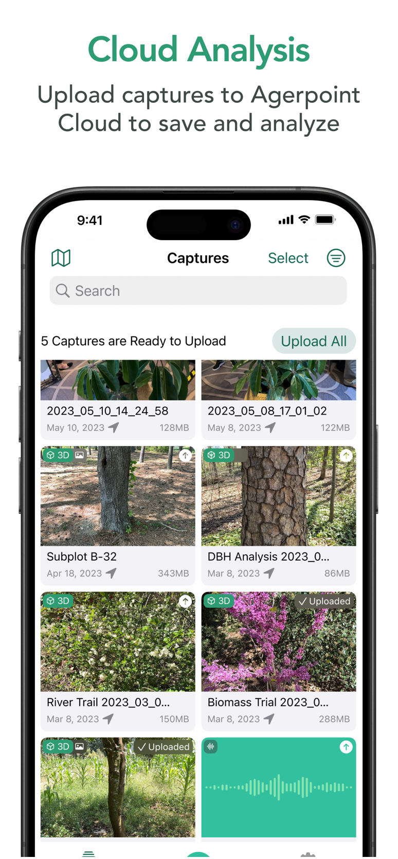
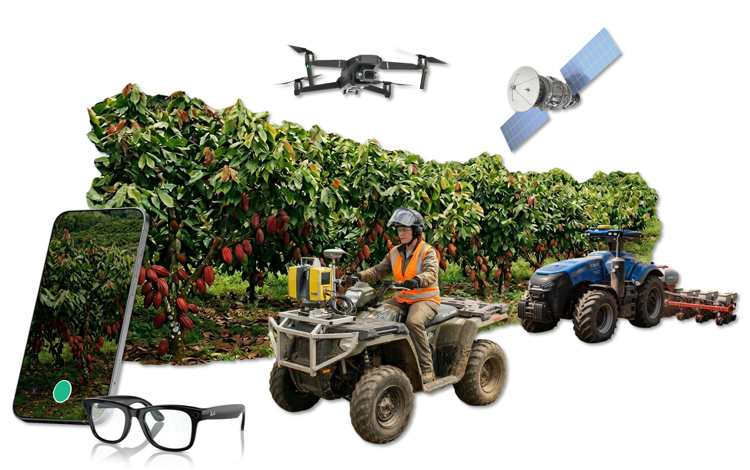
Agerpoint Cloud fuses Captures with other data layers from satellites, drones, ground vehicles, and IoT sensors.
The platform also integrates field observations, weather, soil moisture, and more.
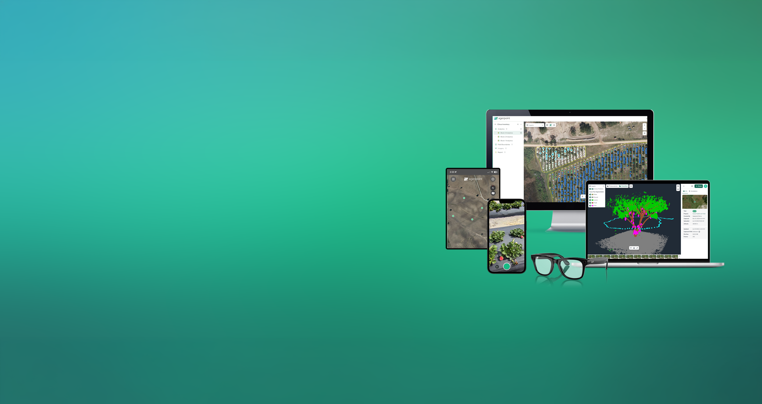
Agerpoint Capture App
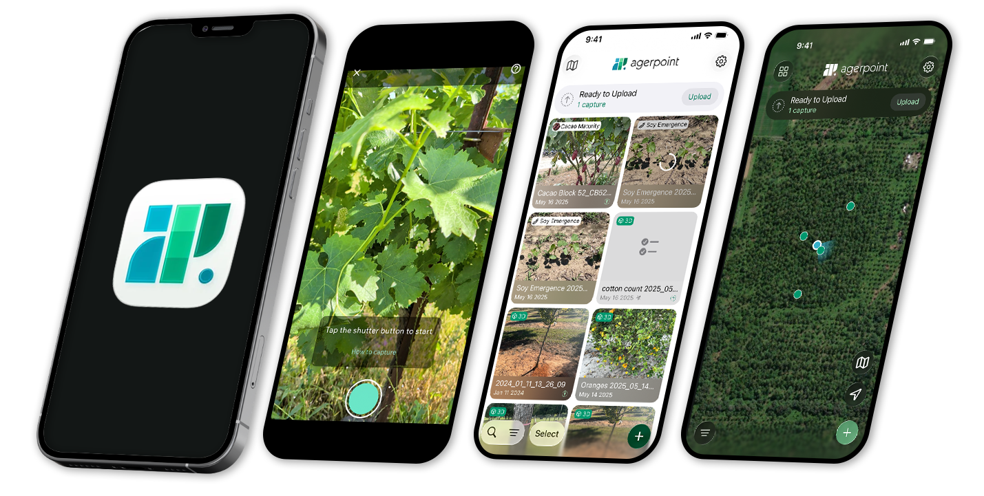
The Agerpoint Capture mobile app captures high-quality field data with accessible modalities such as mobile cameras, wearables, GPS, and LiDAR sensors.


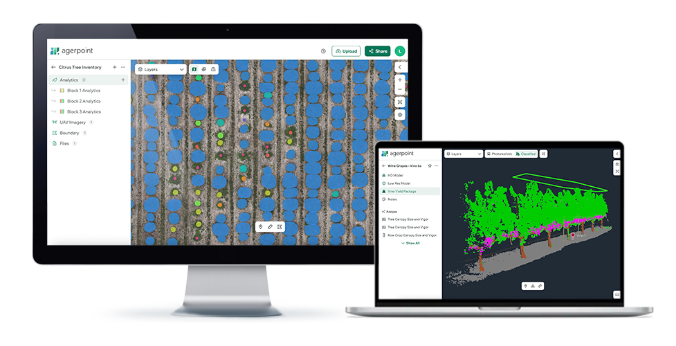
Agerpoint Cloud Platform
The Agerpoint Cloud platform fuses mobile captures with other spatial data to analyze plant data, explore visualizations, and identify insights for better decision-making.
Explore an Interactive 3D Model
Press play to interact. Drag to rotate, scroll to zoom.
3D model of Tree Inventory and Biomass captured with smartphone
Process
Fuse captures with spatial and in-house data, then develop custom ML models for AI-powered measurement, modeling, and mapping
Capture
Capture field data in the sky with satellites and UAVs and on the ground with smartphones and wearables
Identify insights that lead to better decisions for:
Plant Health
Yield & Harvest
Procurement
Resource Allocation
Food Safety
Biodiversity
Sustainability
Regulatory Requirements
Inform
Professional Services

Training and Data Acquisition
Agerpoint Capture and Agerpoint Cloud software training
In-field data acquisition training and certification
Custom Software Development
Mobile and Cloud Development
API integration services

Data Science
Aggregation and fusion of geospatial data
Machine learning model development and data interpretation
Technology Evaluation and Implementation
Technology evaluation and proof-of-concept
Implementation support