
Develop A Complete Data Set For Continual Learning And Growth
OUR OBJECTIVE
Collect, produce, and enhance data sets for pesticide, pruning, and management practice trials
We collected blocks that were able to be ground navigated using our existing ground LiDAR. In addition, we were able to produce data sets for other blocks that were not able to be navigated on the ground with 5/10-Band Multispectral, allowing for future data fidelity with aerial Geiger Mode LiDAR (GML).
Overlay of machine learning crown detection (white point) with derived canopy location from imagery (blue outlines).

OUR APPROACH
Process, assemble and fuse ground and aerial data
We fused collected data with local yield and visual disease assessment data to provide our client’s Plant Scientists a full picture down to the individual tree level. Utilizing either LiDAR or a machine learning multispectral image-based method as Layer 0, we could establish a geo-rectified database of blocks and then fuse local, hand-collected yield, disease, and handheld sensor data to create Layer 0 + 1.
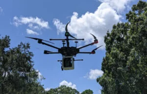
Blocks were scanned with a combination of terrestrial-based LiDAR or aerial-based multispectral imagery. Future collection with aerial GML LiDAR will improve fidelity.
OUR RESULTS
Scalable solutions for early disease detection and calibration for farm management practices
With the data sets for all blocks in a unified, geo-rectified location, our client’s Plant Scientists are now able to scale solutions across locations to optimize practices and results.